
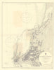

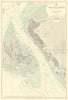

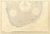

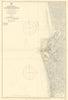

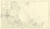

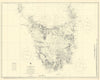

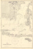


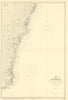

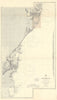

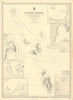

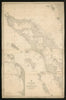

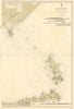

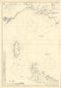

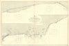

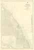

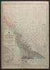

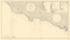

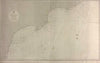


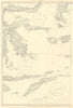
Our extensive nautical charts collection spans over three centuries of maritime history, from early coastal surveys to 20th-century naval navigation. Highlights include British Admiralty charts—renowned for their precision and authority—with hundreds of examples dating from the early 19th century through to the mid-20th century. We also stock significant works by Jacques-Nicolas Bellin, Joseph Roux, and other major French hydrographers, including scarce plates from the Recueil des plans des Ports & Rades and Dépôt de la Marine. Early British mapping is represented by Mount & Page’s The English Pilot and Great Britain’s Coasting Pilot by Captain Greenvile Collins. Our holdings reflect the global reach of maritime exploration and trade, with charts covering European coasts, the Mediterranean, North and South America, the Caribbean, the Pacific, India, East Asia, and Australasia. Notable publishers include George Philip, Imray Laurie Norie & Wilson, US Coast & Geodetic Survey, Kriegsmarine, and the East India Company. Many charts feature engraved coastlines, soundings, anchorage points, lighthouses, shipping routes, and richly detailed insets. Whether you're interested in naval warfare, colonial trade, or coastal topography, this collection offers a compelling visual history of the world at sea.
EU orders up to €150 are sent VAT- and duty-paid — no additional charges on arrival
Authenticity Guaranteed - We only sell original antique & vintage items
Can we help? Call us on +44-208-960-3476 • FAQs
All our products are exempt from US tariffs — no additional duties or taxes payable on arrival.
- Shop by Country
- Shop by Cartographer
- Shop Maps by Type
- Shop Prints by Subject