
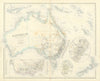


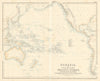

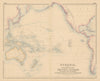


Island chains, shipping routes and the wider Pacific give these maps of Australasia a far broader scope than Australia alone. Regional sheets by SDUK, Swanston, Johnston and others set Australia and New Zealand beside the East Indies, Melanesia and Polynesia, in the varying groupings atlas publishers used for the region. Port plans and shipping maps follow the sea links between islands and coasts, thematic maps show industries, colonial possessions and explorers' routes, and later pictorial maps describe the region in a different way. The prints show its places and peoples.
EU orders up to €150 are sent VAT- and duty-paid — no additional taxes on arrival
Authenticity Guaranteed - We only sell original antique & vintage items
Can we help? Call us on +44-208-960-3476 • FAQs
All our products are exempt from US tariffs — no additional duties or taxes payable on arrival.


- Shop by Country
- Shop by Cartographer
- Shop Maps by Type
- Shop Prints by Subject