


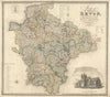


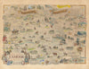


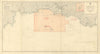


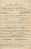
Robert Morden's Devonshire, borough plans of Dartmouth and South Molton and a view along Fore Street in Totnes show Devon at very different scales. Nineteenth-century parliamentary mapping joins the county maps, while Charles E. Hannaford's Totnes view looks along a town street rather than down on its plan. The material runs from early county mapping to the twentieth century, so names, boundaries and publishing styles change across the collection.
EU orders up to €150 are sent VAT- and duty-paid — no additional taxes on arrival
Authenticity Guaranteed - We only sell original antique & vintage items
Can we help? Call us on +44-208-960-3476 • FAQs
All our products are exempt from US tariffs — no additional duties or taxes payable on arrival.


- Shop by Country
- Shop by Cartographer
- Shop Maps by Type
- Shop Prints by Subject