








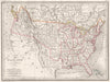


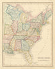




Texas as an independent republic, as part of Mexico and as an American state can all be found in these maps, which follow an unusually distinctive historical sequence. Nineteenth-century sheets by SDUK, Johnson, Tallis and others record these changes, county maps follow later settlement, and coastal charts show the Gulf approaches around Galveston and Corpus Christi. The prints include Indigenous subjects and frontier encounters, among them Catlin's Comanche scenes in later issues. Twentieth-century pictorial and thematic maps turn to oil, farming, army posts and the state's links with its neighbours.
EU orders up to €150 are sent VAT- and duty-paid — no additional taxes on arrival
Authenticity Guaranteed - We only sell original antique & vintage items
Can we help? Call us on +44-208-960-3476 • FAQs
All our products are exempt from US tariffs — no additional duties or taxes payable on arrival.


- Shop by Country
- Shop by Cartographer
- Shop Maps by Type
- Shop Prints by Subject