


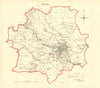


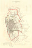

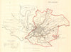


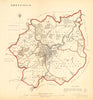

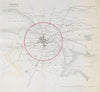


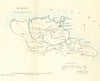

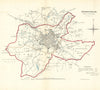

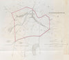

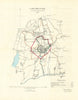

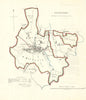

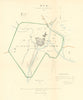

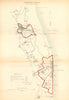

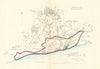

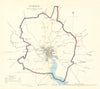

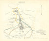

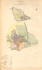

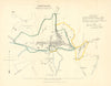

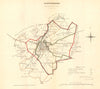

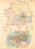

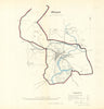

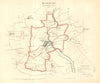

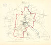

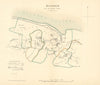

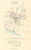

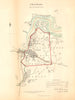
Captain Robert Kearsley Dawson (1798-1861) was an English surveyor and cartographer. He trained at the Royal Military Academy, Woolwich, and was commissioned into the Royal Engineers in 1816. Between 1819 and 1829 he took part in the triangulation and mapping of Ireland and Scotland under Thomas Colby. In 1830, the Home Secretary Lord Melbourne instructed the boundary commissioner Thomas Drummond to arrange a survey of the boundaries of the proposed Parliamentary Boroughs of England and Wales for the Great Reform Act Bill (1832). This was a major task given that no electoral survey had ever previously been undertaken, and many northern towns had not yet been mapped by the Ordnance Survey. Dawson was chosen to undertake the responsibility. We stock below a good selection of his resulting one-inch and two-inch maps, published in Hansard, which provide a fascinating and detailed historical record of many of our towns and cities, and are notable for being among the earliest British lithographic maps. Later work included his Plans of the most Capital Cities of every Empire (1833-1850).
EU orders up to €150 are sent VAT- and duty-paid — no additional charges on arrival
Authenticity Guaranteed - We only sell original antique & vintage items
Can we help? Call us on +44-208-960-3476 • FAQs
All our products are exempt from US tariffs — no additional duties or taxes payable on arrival.
- Shop by Country
- Shop by Cartographer
- Shop Maps by Type
- Shop Prints by Subject