GREECE Turkey in Europe British Ionian Islands Cyclades Aegean.ETTLING 1862 map
SKU: P-8-010158
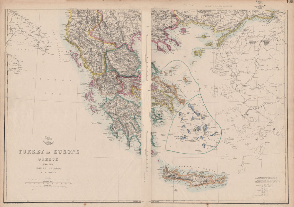
'Turkey in Europe Greece and the Ionian Islands'
The map shows the United States of the Ionian Islands as a separate entity from Greece and Turkey, a state and amical protectorate of the United Kingdom that existed between 1815 and 1864. It covered the territory of the Ionian Islands, located in modern Greece, to whom it was ceded as a gift of the United Kingdom to the newly enthroned King George I, at the end of the protectorate. The Kingdom of Greece, with its original 1832 borders in shown.
Browse available examples:
Size 46 x 66 cm | 18.0 x 26.0 inches
Date Published: 1862
Type: Antique map with original outline colour
Author: Ettling, Theodore
Publication: Cassell's Weekly Dispatch Atlas
Condition: Fair |
Delivery & Returns
Packing
Items smaller than A4 size are usually packed in a stiffened, board-backed envelope. Larger items are rolled and packed in postal tubes. Large items which are too stiff to be rolled in wide-diameter tubes are mailed in all-board envelopes. In the unlikely event of damage in transit, please send the affected item or items back to us and we will provide a replacement or refund.
Delivery
Economy, tracked and express shipping options are available to all destinations worldwide. Over half our orders are sent to customers outside the United Kingdom and we have supplied over 30,000 buyers in over 70 different countries. We ship orders virtually every business day to customers in North America and Europe. The cost of delivery depends on the size of the largest item in your order, where you are located, and the delivery method that you choose at checkout. For orders received before 2pm, we can arrange delivery next day in the UK, within 2 business days to continental Europe and North America, and within 4 days to most other countries worldwide (excludes PO Box or APO/FPO (Military) addresses).
Returns
We accept returns for any reason if sent back to us within 14 days of receipt of your order. If any of your items are not as described, we will provide a full refund including reasonable return postage costs upon safe return to us. If you have changed your mind, you are responsible for the cost of returning the item to us. We describe the size, age and condition of all our products as fully and accurately as possible. Most of the items which we sell are in very good condition. However, the condition of antique and vintage prints and maps can vary. All of our product listings including a statement which classifies the condition as being either “Good”, “Fair”, or (rarely) “Poor” and which describes any material flaws, blemishes, imperfections or other significant features such as folds. Please read the description carefully before purchase.
Can we help? For more details or any questions.