
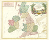

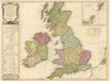

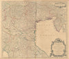

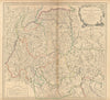

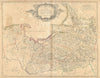

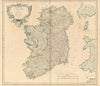

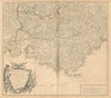

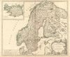

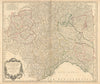

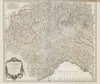

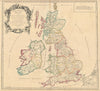

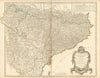

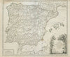


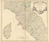

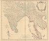

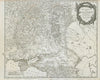

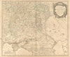

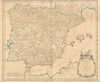

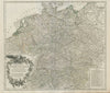

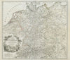

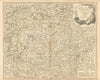

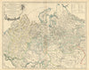

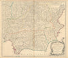

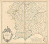

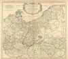

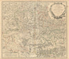

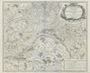

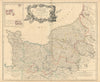

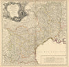

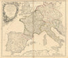

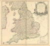

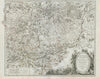

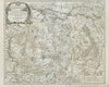
Gilles Robert de Vaugondy (1688–1766), also known as Le Sieur or Monsieur Robert, and his son, Didier Robert de Vaugondy (c.1723–1786), were leading cartographers in France during the 18th century. In 1757, they published their Atlas Universel, one of the most important atlases of that century. In 1760, Didier Robert de Vaugondy was appointed geographer to Louis XV. Father and son collaborated closely, and attribution is not always clear. Gilles often signed maps as "M.Robert", while Didier commonly signed his maps as "Robert de Vaugondy", or added "fils" or "filio" after his name. The Robert de Vaugondys were descended from the Nicolas Sanson family through Sanson's grandson, Pierre Moulard-Sanson. From him, they inherited much of Sanson's cartographic material, which they combined with maps and plates acquired after Hubert Jaillot's death in 1712 to form the basis the Atlas Universel.
EU orders up to €150 are sent VAT- and duty-paid — no additional charges on arrival
Authenticity Guaranteed - We only sell original antique & vintage items
Can we help? Call us on +44-208-960-3476 • FAQs
All our products are exempt from US tariffs — no additional duties or taxes payable on arrival.
- Shop by Country
- Shop by Cartographer
- Shop Maps by Type
- Shop Prints by Subject