Hide out of stock items


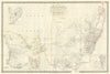


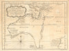

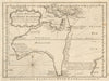


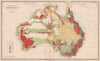


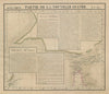

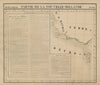

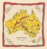

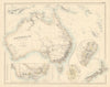

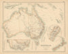


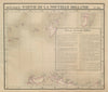


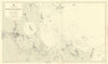


Antique maps and old prints of Australia. Towns plans of Sydney, Adelaide, Melbourne. States & territory maps of New South Wales, Victoria, Queensland, South Australia, Northern Territory, Tasmania & Western Australia by Weller, SDUK, Blackie. Charts of early exploration & discovery. We have large maps and prints from Andrew Garran's "Picturesque atlas of Australasia" (1889), steel engravings from Edwin Carton Booth's "Australia Illustrated" (1875) by Skinner Prout, Chevalier &c, engravings from "Cassell's Picturesque Australasia" (1890); geology maps, and plans & sections of Victorian gold mines from the "Geological Survey of Victoria" (1908), watercolour prints by Percy Spence (1910), photographic prints of "South Australia" (1900)