Hide out of stock items


![The [Channel] Islands of Guernsey, Jersey, Alderney & Sark… GENTS MAG 1779 map](http://www.antiquemapsandprints.com/cdn/shop/files/P-6-081006a.jpg?v=1748715814&width=3000)
![The [Channel] Islands of Guernsey, Jersey, Alderney & Sark… GENTS MAG 1779 map](http://www.antiquemapsandprints.com/cdn/shop/files/P-6-081006a_100x100.jpg?v=1748715814)

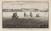


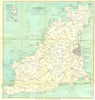

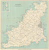


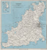

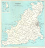

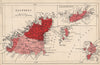


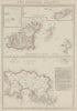

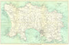

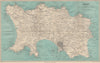


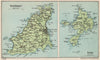

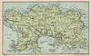

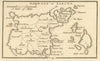
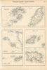
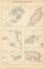
Antique maps and old prints of the Channel Islands of Jersey, Guernsey, Alderney & Sark. Vintage Ward Lock island maps and town plans of St Helier & St Peter Port. Maps of the archipelago by Mallet (1683), Tallis/Rapkin (1851), Philip, Bacon, Stanford, Weller & Baedeker. Steel engravings from by Mudie (1838-1855) & from "Harwood's Illustrations of Jersey" (c1855), Watercolour prints by HB Wimbush (1904)