Hide out of stock items

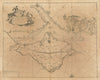


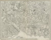


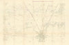


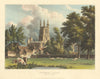


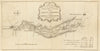


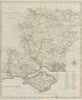

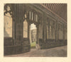

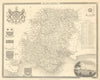

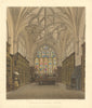


Antique maps & old prints of Hampshire & the south coast. County maps by Bacon, Philip, Cary, Morden & Moule. Antique views & town plans of Winchester, Southampton, Portsmouth & Basingstoke by Ward Lock (1920's-1960's), Dawson (1832) and Creighton/Walker from Lewis's "Topographical Dictionary"(1835). Steel engravings from Brannon's "Picture of Southampton" (1853), old prints from "Recording Britain" (1946-1949), 19th century engravings from the "Illustrated London News", prints of "Famous Cricketers and Cricket grounds" (1896), Copperplate views from Grose's "Antiquities of England" (1776), and road strip maps by Owen/Bowen from "Britannia Depicta"(1753). Watercolour prints by Wilfrid Ball (1909-1915) & Haslehust (1920)