Hide out of stock items


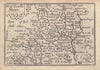

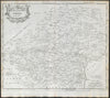

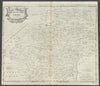

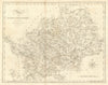

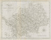


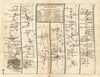


Antique maps & old prints of Hertfordshire. County maps by Bacon, BR Davies, Philip, Cary, Morden & Moule. Antique views & town plans of Hertford, St Albans, Hitchin & Hatfield by Dawson (1832) and Creighton/Walker from Lewis's "Topographical Dictionary"(1835). Vintage street maps of outer London suburbs (Borehamwood, Cheshunt, Edgware, Stanmore, Rickmansworth) from Geographia's "Authentic Map Directory" (1920's-1930's). Old prints from "Recording Britain" (1946-1949), 19th century engravings from the "Illustrated London News", Copperplate views from Grose's "Antiquities of England" (1776), and road strip maps by Owen/Bowen from "Britannia Depicta"(1753).