Hide out of stock items


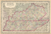


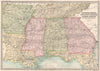

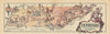

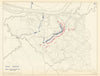

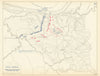

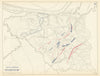


Antique maps & old prints of Tennessee. We stock early state maps by Buchon from "Deux Ameriques" (1825), "Encyclopedia Britannica" state maps (1898 & 1903), USCGS triangulation & coastal survey maps (1870-1889), 19th century engravings from the "Illustrated London News", prints & sketch maps from "Universal Geography" by Elisee Reclus (1885), "Encyclopaedia Americana" maps and plans, decorative maps of the states and territories of the United States from Colton's "General Atlas" (1863) and "Octavo Atlas of the Union" (1864), from Arrowsmith & Lewis's "New and Elegant General Atlas" (1812), and from Rand McNally's "Unrivaled Atlas" (1912). Maps of the region by SDUK (Society for the Diffusion of Useful Knowledge - 1840s)