







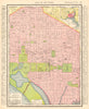












Antique maps & old prints of Washington DC / District of Columbia. We stock early state maps by Buchon from "Deux Ameriques" (1825), William Cullen Bryant prints from "Picturesque America" (1874), antique Baedeker touring maps & city plans (1904-1909), steel engravings by W.H. Bartlett from "American Scenery" (1840), town plans from Appleton's Guide to the United States (1893), 19th century engravings from the "Illustrated London News", prints & sketch maps from "Universal Geography" by Elisee Reclus (1885), halftone prints from "Voyage a Travers d'Amerique" (1895), "Encyclopaedia Americana" maps and plans, decorative maps of the states and territories of the United States from Colton's "General Atlas" (1863) and "Octavo Atlas of the Union" (1864), from Arrowsmith & Lewis's "New and Elegant General Atlas" (1812), and from Rand McNally's "Unrivaled Atlas" (1912). Maps of the region by SDUK (Society for the Diffusion of Useful Knowledge - 1840s)
EU orders up to €150 are sent VAT- and duty-paid — no additional taxes on arrival
Authenticity Guaranteed - We only sell original antique & vintage items
Can we help? Call us on +44-208-960-3476 • FAQs
All our products are exempt from US tariffs — no additional duties or taxes payable on arrival.


- Shop by Country
- Shop by Cartographer
- Shop Maps by Type
- Shop Prints by Subject