
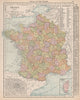


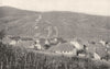


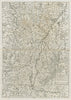

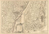


Strasbourg, Alsatian vineyards and four centuries of shifting frontiers run through these maps and prints of Alsace, dating from 1572 to 1974. Sebastian Münster's sixteenth-century maps show the Lièpvre valley and silver working at Val d'Argent, and later sheets by Seutter, Rossi and Sanson place the region beside Baden-Württemberg and Swabia. Stanford maps show it within the German Empire as part of Alsace-Lorraine, while French departmental maps of the late nineteenth century leave it out, and twentieth-century administrative and ethnic maps by Philip, Hammond, Lowry and Hughes follow the later changes. Wine maps by Willy Fischer, Rémy Hétreau, Féret, Edery and Nicolas chart the vineyards, and First World War propaganda adds a further chapter.
EU orders up to €150 are sent VAT- and duty-paid — no additional taxes on arrival
Authenticity Guaranteed - We only sell original antique & vintage items
Can we help? Call us on +44-208-960-3476 • FAQs
All our products are exempt from US tariffs — no additional duties or taxes payable on arrival.


- Shop by Country
- Shop by Cartographer
- Shop Maps by Type
- Shop Prints by Subject