
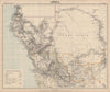


Old African kingdoms, Portuguese colonial mapping and routes deep into the interior give these maps of Angola several overlapping histories, from the seventeenth century into the twentieth. Bellin's charts follow Luanda, Benguela and the rivers between them, and earlier regional sheets name Kongo, Angola and neighbouring territories. Vandermaelen's atlas sections and later expedition maps reach across the Cuanza basin and through Bié towards central Africa, and geological, vegetation and agricultural maps show resources and cultivation. The prints show Luanda, M'banza-Kongo, inland communities and landscapes, along with subjects connected with the Atlantic slave trade and European descriptions of local people.
EU orders up to €150 are sent VAT- and duty-paid — no additional taxes on arrival
Authenticity Guaranteed - We only sell original antique & vintage items
Can we help? Call us on +44-208-960-3476 • FAQs
All our products are exempt from US tariffs — no additional duties or taxes payable on arrival.


- Shop by Country
- Shop by Cartographer
- Shop Maps by Type
- Shop Prints by Subject