Skip to content
Your basket
Product image
Product
Total
Quantity
North Devon Coast. Ilfracombe Minehead Lynton 1920 old antique map plan chart
$12.00
$12.00
Decrease quantity for North Devon Coast. Ilfracombe Minehead Lynton 1920 old antique map plan chart
Increase quantity for North Devon Coast. Ilfracombe Minehead Lynton 1920 old antique map plan chart
Loading...
EU orders up to €150 are sent VAT- and duty-paid
— no additional taxes on arrival
Authenticity Guaranteed - We only sell
original antique
&
vintage
items
Can we help
? Call us on +44-208-960-3476 •
FAQs
All our products are exempt from US tariffs
— no additional duties or taxes payable on arrival.
What's New
Shop Maps & Prints
Shop by Country
Shop by Cartographer
Shop Maps by Type
Shop Prints by Subject
Best Maps
FAQs
Africa
South Africa
Egypt
Asia
India
China
Malaysia & Singapore
Hong Kong
Indonesia
Australasia
Australia
New Zealand
British Isles
England
Cornwall
Devon
Kent
Lancashire
London
Oxfordshire
Yorkshire
Surrey
Sussex
Ireland
Scotland
Wales
Europe
Austria
France
Germany
Greece
Italy
Malta
Netherlands
Norway
Poland
Portugal
Russia
Spain
Switzerland
Middle East
Israel / Palestine
Iran
Saudi Arabia
North America
Canada
United States
California
Florida
Illinois
New York
Pennsylvania
Texas
Polar Regions
South & Central America
Mexico
Brazil
Oceans & Islands
Pacific
Atlantic
Caribbean
Indian
World
Shop All Countries
A-B
Admiralty (British)
Bacon, George Washington
Beck, Harry
Bellin, Jacques-Nicolas
Booth, Charles
C-G
Cary, John
Collins, Greenville
Colton, Joseph Hutchins
Faden, William
Geographia
H-J
H.M.S.O.
Hall, Sidney
Hétreau, Rémy
Japanese Government Railways
Johnson, Alvin Jewett
K-L
Langenes, Barent
Lewis, Samuel & Creighton, Roger
Keere, Pieter van den
Larmat, Louis
Lodge, John
M-O
Mallet, Allain Manesson
Moll, Hermann
Morden, Robert
Munster, Sebastian
Ordnance Survey
P-S
Porcacchi, Tomaso
Rossi, Giovanni Giacomo de
S.D.U.K.
Speed, John
Stanford, Edward
T-V
Tallis, John
Thomson, John
Tolkien, J.R.R.
Vandermaelen, Philippe
Vaugondy, Robert de
W-Z
Walker, John & Charles
Ward Lock & Co
Weller, Edward
Wyld, James
Shop All Cartographers
Wine Maps
Road Strip Maps
Pictorial Maps
Town & City Plans
Neighbourhood Maps
City of London Ward Maps
London Parish Maps
Insurance Maps
London Underground Maps
Panoramic Maps
Nautical Charts
Geological Maps
Provincial Maps
British Isles County Maps
US State Maps
French Department Maps
Fantasy Maps
Star charts
Tour de France maps
Military Maps
American Revolutionary War
American Civil War
First World War
Second World War
Animals & Birds
Birds
Butterflies & Moths
Dogs
Fish & Marine Animals
Astronomy & Celestial
Botanical & Florals
Cartoons, Fantasy & Fairy Tales
Flower Fairies
Vanity Fair Spy Cartoons
Flags & Vexillology
Landscapes & Seascapes
Military & Naval
People, Portraits & Fashion
Celebrities & Royalty
Children & Family
Fashion & Traditional Dress
Religion
Society
Tribal
Religious Buildings
Ships & Maritime
Sports & Hobbies
Golf
Cricket
Riding, Hunting & Shooting
Horse Racing & Jockeys
Sailing
Rowing
Polo
Athletics
Trade & Professions
Business & Industry
Education
Engineering & Science
Farming & Fishermen
Law
Literary
Medicine
Performing Arts
Town Views
Shop All Subjects
About
Contact
Basket
1
1 item
Shop by Country
Shop by Country
Shop All Countries
Africa
Africa
South Africa
Egypt
Asia
Asia
India
China
Malaysia & Singapore
Hong Kong
Indonesia
Australasia
Australasia
Australia
New Zealand
British Isles
British Isles
England
Cornwall
Devon
Kent
Lancashire
London
Oxfordshire
Yorkshire
Surrey
Sussex
Ireland
Scotland
Wales
Europe
Europe
Austria
France
Germany
Greece
Italy
Malta
Netherlands
Norway
Poland
Portugal
Russia
Spain
Switzerland
Middle East
Middle East
Israel / Palestine
Iran
Saudi Arabia
North America
North America
Canada
United States
California
Florida
Illinois
New York
Pennsylvania
Texas
Polar Regions
South & Central America
Mexico
Brazil
Oceans & Islands
Oceans & Islands
Pacific
Atlantic
Caribbean
Indian
World
Shop by Cartographer
Shop All Cartographers
A-B
A-B
Admiralty (British)
Bacon, George Washington
Beck, Harry
Bellin, Jacques-Nicolas
Booth, Charles
C-G
C-G
Cary, John
Collins, Greenville
Colton, Joseph Hutchins
Faden, William
Geographia
H-J
H-J
H.M.S.O.
Hall, Sidney
Hétreau, Rémy
Japanese Government Railways
Johnson, Alvin Jewett
K-L
K-L
Langenes, Barent
Lewis, Samuel & Creighton, Roger
Keere, Pieter van den
Larmat, Louis
Lodge, John
M-O
M-O
Mallet, Allain Manesson
Moll, Hermann
Morden, Robert
Munster, Sebastian
Ordnance Survey
P-S
P-S
Porcacchi, Tomaso
Rossi, Giovanni Giacomo de
S.D.U.K.
Speed, John
Stanford, Edward
T-V
T-V
Tallis, John
Thomson, John
Tolkien, J.R.R.
Vandermaelen, Philippe
Vaugondy, Robert de
W-Z
W-Z
Walker, John & Charles
Ward Lock & Co
Weller, Edward
Wyld, James
Shop Maps by Type
Shop Maps by Type
Wine Maps
Road Strip Maps
Pictorial Maps
Town & City Plans
Town & City Plans
Neighbourhood Maps
City of London Ward Maps
London Parish Maps
Insurance Maps
London Underground Maps
Panoramic Maps
Nautical Charts
Geological Maps
Provincial Maps
Provincial Maps
British Isles County Maps
US State Maps
French Department Maps
Fantasy Maps
Star charts
Tour de France maps
Military Maps
Military Maps
American Revolutionary War
American Civil War
First World War
Second World War
Shop Prints by Subject
Shop All Subjects
Animals & Birds
Animals & Birds
Birds
Butterflies & Moths
Dogs
Fish & Marine Animals
Astronomy & Celestial
Botanical & Florals
Cartoons, Fantasy & Fairy Tales
Flower Fairies
Vanity Fair Spy Cartoons
Flags & Vexillology
Landscapes & Seascapes
Military & Naval
People, Portraits & Fashion
Celebrities & Royalty
Children & Family
Fashion & Traditional Dress
Religion
Society
Tribal
Religious Buildings
Ships & Maritime
Sports & Hobbies
Sports & Hobbies
Golf
Cricket
Riding, Hunting & Shooting
Horse Racing & Jockeys
Sailing
Rowing
Polo
Athletics
Trade & Professions
Trade & Professions
Business & Industry
Education
Engineering & Science
Farming & Fishermen
Law
Literary
Medicine
Performing Arts
Town Views
Australia
"Twofold Bay", by E.C. BOOTH/Sir Oswald Walters Brierly. NSW, Australia c1874
Sold
AUSTRALIA & NEW ZEALAND. NSW Victoria SA QLD; Canterbury Alps. BUTLER 1888 map
Sold
AUSTRALIA. Christmas in-Feast, diggings 1856 old antique vintage print picture
Sold
AUSTRALIA. Shows NT as 'Alexandra Land', part of SA. BARTHOLOMEW 1878 old map
Sold
AUSTRALIA. York, in Western Australia 1857 old antique vintage print picture
Sold
AUSTRALIA.Panter-Harding-Goldwyer expdn.Explorer's remains,Lagrange Bay 1865
Sold
Asia, Australia & New Zealand. Commercial. Import & export routes 1925 old map
Sold
BRITISH EMPIRE Route Chart to India, Far East, Australia & New Zealand 1909 map
Sold
CENTRAL AUSTRALIA.Simpson/Sturt Stony deserts.Winnecke.QLD NT SA.RGS 1884 map
Sold
Chalks No. 3 Consolidated Gold Mine, Carisbrook. Victoria, Australia 1909 map
Sold
NSW. Ledger's Alpacas & Llamas, Sophienburg, Atkinson 1861 old antique print
Sold
The great equatorial telescope for Melbourne. Victoria Australia 1868 print
Sold
"Night Scene in the Diggings", by E.C. BOOTH/John Skinner PROUT. Australia c1874
Sold
"Port Stephens ", by Edwin Carton BOOTH/John Skinner PROUT. NSW, Australia c1874
Sold
AUSTRALIA NEW ZEALAND FIJI NEW HEBRIDES Protestant Mission stations 1911 map
Sold
AUSTRALIA Showing explorers' routes with dates Railways JOHNSTON 1901 old map
Sold
AUSTRALIA. A letter from Australia 1858 old antique vintage print picture
Sold
AUSTRALIA. Aboriginal Mode of Disposal of Dead 1857 old antique print picture
Sold
AUSTRALIA. Australia 1886 old antique vintage map plan chart
Sold
AUSTRALIA. Banks of the river Hutt 1847 old antique vintage print picture
Sold
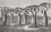
AUSTRALIA. Bottle-trees of Queensland 1873 old antique vintage print picture
Sold
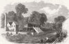
AUSTRALIA. Lambton colliery, Newcastle, NSW 1863 old antique print picture
Sold
AUSTRALIA. Map 1870 old antique vintage plan chart
Sold
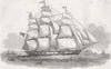
AUSTRALIA. New Australian emigrant ship Ben Nevis 1852 old antique print
Sold
AUSTRALIA. Population structure cities. Sydney Melbourne Brisbane RGS map 1965
Sold
AUSTRALIA. Salmon ponds at New Norfolk 1867 old antique vintage print picture
Sold
AUSTRALIA. Tasmania or Van Diemen's Land. Bacon 1895 old antique map chart
Sold
AUSTRALIA. The Commonwealth of Australia. States.. STANFORD 1906 old map
Sold
AUSTRALIA. Victoria NSW & south 1870 old antique vintage map plan chart
Sold
Aboriginal "Native Encampment ", by E.C. BOOTH/J.S. PROUT. Australia c1874
Sold
Barossa Valley wine region sketch map. South Australia wineries 1955 old
Sold
CHESHIRE. Australian emigration dock, Birkenhead 1852 old antique print
Sold
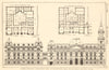
Melbourne Town Hall, Swanston & Collins Streets. Grainger Kennedy Little 1907
Sold
NEW SOUTH WALES. Forest scene on the Illawarra Mountains. Australia 1868 print
Sold
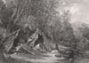
NSW. Missionary rev Vanderkiste lost in mountains 1859 old antique print
Sold
New South Wales (Eastern Section) state map. Australia. CRAM 1894 old
Sold
1
…
45
46
47
48
49
…
62
Back to Top
Choosing a selection results in a full page refresh.
Opens in a new window.
About this double-sided map
Understood