
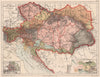

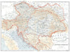

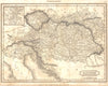

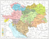

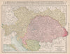

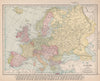
Bohemia, Galicia, Transylvania, Dalmatia and Croatia appear under their contemporary names in these maps of Austria Hungary, a multinational empire whose lands cross many of today's frontiers. Nineteenth-century atlas sheets by Johnston, Stanford, Johnson and others record the Austrian Empire and then the Dual Monarchy within central and southeastern Europe, often beside the German states, Italy and the Ottoman lands, and railway maps link Vienna and Budapest with the provinces. Later sheets show the new national divisions that followed the empire's dissolution after the First World War, and prints add its towns and architecture.
EU orders up to €150 are sent VAT- and duty-paid — no additional taxes on arrival
Authenticity Guaranteed - We only sell original antique & vintage items
Can we help? Call us on +44-208-960-3476 • FAQs
All our products are exempt from US tariffs — no additional duties or taxes payable on arrival.


- Shop by Country
- Shop by Cartographer
- Shop Maps by Type
- Shop Prints by Subject