Skip to content
Your cart is empty
Continue shopping

Have an account?

Log in to check out faster.

Your cart

Loading...

Estimated total

£0.00 GBP

Taxes included. Discounts and shipping calculated at checkout.
EU orders up to €150 are sent VAT- and duty-paid — no additional taxes on arrival
Authenticity Guaranteed - We only sell original antique & vintage items
Can we help? Call us on +44-208-960-3476 • FAQs
All our products are exempt from US tariffs — no additional duties or taxes payable on arrival.
  • What's New
  • Shop Maps & Prints
    • Shop by Country

    • Shop by Cartographer

    • Shop Maps by Type

    • Shop Prints by Subject

    • Best Maps
    • FAQs
    • Africa
      • South Africa
      • Egypt
      Asia
      • India
      • China
      • Malaysia & Singapore
      • Hong Kong
      • Indonesia
      Australasia
      • Australia
      • New Zealand
    • British Isles
      • England
        • Cornwall
        • Devon
        • Kent
        • Lancashire
        • London
        • Oxfordshire
        • Yorkshire
        • Surrey
        • Sussex
      • Ireland
      • Scotland
      • Wales
    • Europe
      • Austria
      • France
      • Germany
      • Greece
      • Italy
      • Malta
      • Netherlands
      • Norway
      • Poland
      • Portugal
      • Russia
      • Spain
      • Switzerland
    • Middle East
      • Israel / Palestine
      • Iran
      • Saudi Arabia
      North America
      • Canada
      • United States
      • California
      • Florida
      • Illinois
      • New York
      • Pennsylvania
      • Texas
    • Polar Regions South & Central America
      • Mexico
      • Brazil
      Oceans & Islands
      • Pacific
      • Atlantic
      • Caribbean
      • Indian
      World
    • Shop All Countries

    • A-B
      • Admiralty (British)
      • Bacon, George Washington
      • Beck, Harry
      • Bellin, Jacques-Nicolas
      • Booth, Charles
      C-G
      • Cary, John
      • Collins, Greenville
      • Colton, Joseph Hutchins
      • Faden, William
      • Geographia
    • H-J
      • H.M.S.O.
      • Hall, Sidney
      • Hétreau, Rémy
      • Japanese Government Railways
      • Johnson, Alvin Jewett
      K-L
      • Langenes, Barent
      • Lewis, Samuel & Creighton, Roger
      • Keere, Pieter van den
      • Larmat, Louis
      • Lodge, John
    • M-O
      • Mallet, Allain Manesson
      • Moll, Hermann
      • Morden, Robert
      • Munster, Sebastian
      • Ordnance Survey
      P-S
      • Porcacchi, Tomaso
      • Rossi, Giovanni Giacomo de
      • S.D.U.K.
      • Speed, John
      • Stanford, Edward
    • T-V
      • Tallis, John
      • Thomson, John
      • Tolkien, J.R.R.
      • Vandermaelen, Philippe
      • Vaugondy, Robert de
      W-Z
      • Walker, John & Charles
      • Ward Lock & Co
      • Weller, Edward
      • Wyld, James
    • Shop All Cartographers

    • Wine Maps Road Strip Maps Pictorial Maps Town & City Plans
      • Neighbourhood Maps
      • City of London Ward Maps
      • London Parish Maps
      • Insurance Maps
      • London Underground Maps
    • Panoramic Maps Nautical Charts Geological Maps Provincial Maps
      • British Isles County Maps
      • US State Maps
      • French Department Maps
    • Fantasy Maps Star charts Tour de France maps Military Maps
      • American Revolutionary War
      • American Civil War
      • First World War
      • Second World War
    • Animals & Birds
      • Birds
      • Butterflies & Moths
      • Dogs
      • Fish & Marine Animals
      Astronomy & Celestial Botanical & Florals Cartoons, Fantasy & Fairy Tales
      • Flower Fairies
      • Vanity Fair Spy Cartoons
    • Flags & Vexillology Landscapes & Seascapes Military & Naval People, Portraits & Fashion
      • Celebrities & Royalty
      • Children & Family
      • Fashion & Traditional Dress
      • Religion
      • Society
      • Tribal
    • Religious Buildings Ships & Maritime Sports & Hobbies
      • Golf
      • Cricket
      • Riding, Hunting & Shooting
      • Horse Racing & Jockeys
      • Sailing
      • Rowing
      • Polo
      • Athletics
    • Trade & Professions
      • Business & Industry
      • Education
      • Engineering & Science
      • Farming & Fishermen
      • Law
      • Literary
      • Medicine
      • Performing Arts
      Town Views
    • Shop All Subjects

  • About
  • Contact
Antiquemapsandprints.com Antiquemapsandprints.com
  • Cart
Antiquemapsandprints.com
  • Shop by Country
    • Shop All Countries
    • Africa
      • South Africa
      • Egypt
    • Asia
      • India
      • China
      • Malaysia & Singapore
      • Hong Kong
      • Indonesia
    • Australasia
      • Australia
      • New Zealand
    • British Isles
      • England
        • Cornwall
        • Devon
        • Kent
        • Lancashire
        • London
        • Oxfordshire
        • Yorkshire
        • Surrey
        • Sussex
      • Ireland
      • Scotland
      • Wales
    • Europe
      • Austria
      • France
      • Germany
      • Greece
      • Italy
      • Malta
      • Netherlands
      • Norway
      • Poland
      • Portugal
      • Russia
      • Spain
      • Switzerland
    • Middle East
      • Israel / Palestine
      • Iran
      • Saudi Arabia
    • North America
      • Canada
      • United States
      • California
      • Florida
      • Illinois
      • New York
      • Pennsylvania
      • Texas
    • Polar Regions
    • South & Central America
      • Mexico
      • Brazil
    • Oceans & Islands
      • Pacific
      • Atlantic
      • Caribbean
      • Indian
    • World
  • Shop by Cartographer
    • Shop All Cartographers
    • A-B
      • Admiralty (British)
      • Bacon, George Washington
      • Beck, Harry
      • Bellin, Jacques-Nicolas
      • Booth, Charles
    • C-G
      • Cary, John
      • Collins, Greenville
      • Colton, Joseph Hutchins
      • Faden, William
      • Geographia
    • H-J
      • H.M.S.O.
      • Hall, Sidney
      • Hétreau, Rémy
      • Japanese Government Railways
      • Johnson, Alvin Jewett
    • K-L
      • Langenes, Barent
      • Lewis, Samuel & Creighton, Roger
      • Keere, Pieter van den
      • Larmat, Louis
      • Lodge, John
    • M-O
      • Mallet, Allain Manesson
      • Moll, Hermann
      • Morden, Robert
      • Munster, Sebastian
      • Ordnance Survey
    • P-S
      • Porcacchi, Tomaso
      • Rossi, Giovanni Giacomo de
      • S.D.U.K.
      • Speed, John
      • Stanford, Edward
    • T-V
      • Tallis, John
      • Thomson, John
      • Tolkien, J.R.R.
      • Vandermaelen, Philippe
      • Vaugondy, Robert de
    • W-Z
      • Walker, John & Charles
      • Ward Lock & Co
      • Weller, Edward
      • Wyld, James
  • Shop Maps by Type
    • Wine Maps
    • Road Strip Maps
    • Pictorial Maps
    • Town & City Plans
      • Neighbourhood Maps
      • City of London Ward Maps
      • London Parish Maps
      • Insurance Maps
      • London Underground Maps
    • Panoramic Maps
    • Nautical Charts
    • Geological Maps
    • Provincial Maps
      • British Isles County Maps
      • US State Maps
      • French Department Maps
    • Fantasy Maps
    • Star charts
    • Tour de France maps
    • Military Maps
      • American Revolutionary War
      • American Civil War
      • First World War
      • Second World War
  • Shop Prints by Subject
    • Shop All Subjects
    • Animals & Birds
      • Birds
      • Butterflies & Moths
      • Dogs
      • Fish & Marine Animals
    • Astronomy & Celestial
    • Botanical & Florals
    • Cartoons, Fantasy & Fairy Tales
      • Flower Fairies
      • Vanity Fair Spy Cartoons
    • Flags & Vexillology
    • Landscapes & Seascapes
    • Military & Naval
    • People, Portraits & Fashion
      • Celebrities & Royalty
      • Children & Family
      • Fashion & Traditional Dress
      • Religion
      • Society
      • Tribal
    • Religious Buildings
    • Ships & Maritime
    • Sports & Hobbies
      • Golf
      • Cricket
      • Riding, Hunting & Shooting
      • Horse Racing & Jockeys
      • Sailing
      • Rowing
      • Polo
      • Athletics
    • Trade & Professions
      • Business & Industry
      • Education
      • Engineering & Science
      • Farming & Fishermen
      • Law
      • Literary
      • Medicine
      • Performing Arts
    • Town Views
  • Best Maps
  • What's New
  • About
  • Contact
  • Account

Austria

  • Baedeker, Karl / Wagner & Debes
  • Austria | Austro-Hungarian Empire
  • Czechia
  • Czech Republic | Slovakia | Czechoslovakia
Filter
Clear
Filter
Filter
Sort
Clear All

Showing 1045 of 1045 products Showing 1045 of 1045

Sort
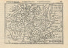
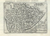
  • Tirolis Comita by Bertius / Langenes. The County of Tyrol 1603 old antique map Tirolis Comita by Bertius / Langenes. The County of Tyrol 1603 old antique map
    Tirolis Comita by Bertius / Langenes. The County of Tyrol 1603 old antique map

    £56.00

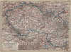
  • AUSTRO-HUNGARIAN MONARCHY Dalmatia Slavonia Siebenburgen &c JOHNSTON 1892 map AUSTRO-HUNGARIAN MONARCHY Dalmatia Slavonia Siebenburgen &c JOHNSTON 1892 map
    AUSTRO-HUNGARIAN MONARCHY Dalmatia Slavonia Siebenburgen &c JOHNSTON 1892 map

    £55.00

  • AUSTRIAN EMPIRE. 'Austria'.Vienna views.Hungary Lombardy TALLIS/RAPKIN 1851 map AUSTRIAN EMPIRE. 'Austria'.Vienna views.Hungary Lombardy TALLIS/RAPKIN 1851 map
    AUSTRIAN EMPIRE. 'Austria'.Vienna views.Hungary Lombardy TALLIS/RAPKIN 1851 map

    £54.00

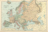
  • EUROPE. Great Powers. Austria-Hungary Turkey in Europe. GW BACON 1898 old map EUROPE. Great Powers. Austria-Hungary Turkey in Europe. GW BACON 1898 old map
    EUROPE. Great Powers. Austria-Hungary Turkey in Europe. GW BACON 1898 old map

    £54.00

  • Germany by Herman Moll. Central Europe. Czechia Austria Switzerland 1701 map Germany by Herman Moll. Central Europe. Czechia Austria Switzerland 1701 map
    Germany by Herman Moll. Central Europe. Czechia Austria Switzerland 1701 map

    £54.00

  • HUNGARY & GALICIA. AUSTRIAN EMPIRE East sheet. Roads. Austria-Hungary 1896 map HUNGARY & GALICIA. AUSTRIAN EMPIRE East sheet. Roads. Austria-Hungary 1896 map
    HUNGARY & GALICIA. AUSTRIAN EMPIRE East sheet. Roads. Austria-Hungary 1896 map

    £54.00

  • Index map Germany Netherlands Switzerland Austria Italy. CHAUCHARD 1800 Index map Germany Netherlands Switzerland Austria Italy. CHAUCHARD 1800
    Index map Germany Netherlands Switzerland Austria Italy. CHAUCHARD 1800

    £54.00

  • Central Europe rivers & regions. Germany Switzerland Austria. CHAUCHARD 1800 map Central Europe rivers & regions. Germany Switzerland Austria. CHAUCHARD 1800 map
    Central Europe rivers & regions. Germany Switzerland Austria. CHAUCHARD 1800 map

    £53.00

  • Johnson's Europe. Austria Hungary Prussia Turkey Papal States 1865 old map Johnson's Europe. Austria Hungary Prussia Turkey Papal States 1865 old map
    Johnson's Europe. Austria Hungary Prussia Turkey Papal States 1865 old map

    £53.00

  • South-west Europe. Iberia France Italy Austria Mediterranean. LIZARS 1842 map South-west Europe. Iberia France Italy Austria Mediterranean. LIZARS 1842 map
    South-west Europe. Iberia France Italy Austria Mediterranean. LIZARS 1842 map

    £53.00

  • EASTERN ALPS. South Bavaria Bayern Austria Slovenia Tirol Wien München 1899 map EASTERN ALPS. South Bavaria Bayern Austria Slovenia Tirol Wien München 1899 map
    EASTERN ALPS. South Bavaria Bayern Austria Slovenia Tirol Wien München 1899 map

    £52.00

  • Austria-Hungary. Croatia Czechia Bohemia Galicia Transylvania. STANFORD 1894 map Austria-Hungary. Croatia Czechia Bohemia Galicia Transylvania. STANFORD 1894 map
    Austria-Hungary. Croatia Czechia Bohemia Galicia Transylvania. STANFORD 1894 map

    £51.00

  • Austria-Hungary. Croatia Czechia Bohemia Galicia Transylvania. STANFORD 1896 map Austria-Hungary. Croatia Czechia Bohemia Galicia Transylvania. STANFORD 1896 map
    Austria-Hungary. Croatia Czechia Bohemia Galicia Transylvania. STANFORD 1896 map

    £51.00

  • Austria-Hungary. Croatia Czechia Bohemia Galicia Transylvania. STANFORD 1901 map Austria-Hungary. Croatia Czechia Bohemia Galicia Transylvania. STANFORD 1901 map
    Austria-Hungary. Croatia Czechia Bohemia Galicia Transylvania. STANFORD 1901 map

    £51.00

  • Austria-Hungary. Croatia Czechia Bohemia Galicia Transylvania. STANFORD 1904 map Austria-Hungary. Croatia Czechia Bohemia Galicia Transylvania. STANFORD 1904 map
    Austria-Hungary. Croatia Czechia Bohemia Galicia Transylvania. STANFORD 1904 map

    £51.00

  • Austria-Hungary. Croatia Czechia Bohemia Galicia Transylvania. STANFORD 1904 map Austria-Hungary. Croatia Czechia Bohemia Galicia Transylvania. STANFORD 1904 map
    Austria-Hungary. Croatia Czechia Bohemia Galicia Transylvania. STANFORD 1904 map

    £51.00

  • BALKAN PENINSULA Greece Austria Rumili Servia Turkey Romania STANFORD 1894 map BALKAN PENINSULA Greece Austria Rumili Servia Turkey Romania STANFORD 1894 map
    BALKAN PENINSULA Greece Austria Rumili Servia Turkey Romania STANFORD 1894 map

    £51.00

  • BALKAN PENINSULA Greece Austria Rumili Servia Turkey Romania STANFORD 1896 map BALKAN PENINSULA Greece Austria Rumili Servia Turkey Romania STANFORD 1896 map
    BALKAN PENINSULA Greece Austria Rumili Servia Turkey Romania STANFORD 1896 map

    £51.00

  • BALKAN PENINSULA Greece Austria Rumili Servia Turkey Romania STANFORD 1896 map BALKAN PENINSULA Greece Austria Rumili Servia Turkey Romania STANFORD 1896 map
    BALKAN PENINSULA Greece Austria Rumili Servia Turkey Romania STANFORD 1896 map

    £51.00

  • BALKAN PENINSULA Greece Austria Rumili Servia Turkey Romania STANFORD 1904 map BALKAN PENINSULA Greece Austria Rumili Servia Turkey Romania STANFORD 1904 map
    BALKAN PENINSULA Greece Austria Rumili Servia Turkey Romania STANFORD 1904 map

    £50.00

  • Germany by Herman Moll. Central Europe. Czechia Austria Switzerland 1709 map Germany by Herman Moll. Central Europe. Czechia Austria Switzerland 1709 map
    Germany by Herman Moll. Central Europe. Czechia Austria Switzerland 1709 map

    £50.00

  • BUDAPEST antique town city plan. Hungary. Magyarorszag terkep 1896 old map BUDAPEST antique town city plan. Hungary. Magyarorszag terkep 1896 old map
    BUDAPEST antique town city plan. Hungary. Magyarorszag terkep 1896 old map

    £49.00

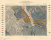
  • Geologische Spezialkarte Öst.-Ung. Monarchie. Hallein Berchtesgaden 1907 map Geologische Spezialkarte Öst.-Ung. Monarchie. Hallein Berchtesgaden 1907 map
    Geologische Spezialkarte Öst.-Ung. Monarchie. Hallein Berchtesgaden 1907 map

    £48.00

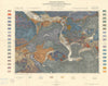
  • Geologische Spezialkarte Öst.-Ung. Monarchie. Ischl Hallstatt. Austria 1905 map Geologische Spezialkarte Öst.-Ung. Monarchie. Ischl Hallstatt. Austria 1905 map
    Geologische Spezialkarte Öst.-Ung. Monarchie. Ischl Hallstatt. Austria 1905 map

    £48.00

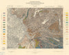
  • Geologische Spezialkarte Öst.-Ung. Monarchie. Salzburg. Austria 50x62cm 1903 map Geologische Spezialkarte Öst.-Ung. Monarchie. Salzburg. Austria 50x62cm 1903 map
    Geologische Spezialkarte Öst.-Ung. Monarchie. Salzburg. Austria 50x62cm 1903 map

    £48.00

  • Vienna / Wien town city plan. Austria. BRADSHAW c1853 old antique map chart Vienna / Wien town city plan. Austria. BRADSHAW c1853 old antique map chart
    Vienna / Wien town city plan. Austria. BRADSHAW c1853 old antique map chart

    £48.00

  • Salisburgensis Diocesis by Bertius / Langenes. The Diocese of Salzburg 1603 map Salisburgensis Diocesis by Bertius / Langenes. The Diocese of Salzburg 1603 map
    Salisburgensis Diocesis by Bertius / Langenes. The Diocese of Salzburg 1603 map

    £47.00

  • CZECHOSLOVAKIA (WESTERN PORTION). Bohemia Moravia. Czech Republic mapa 1929 CZECHOSLOVAKIA (WESTERN PORTION). Bohemia Moravia. Czech Republic mapa 1929
    CZECHOSLOVAKIA (WESTERN PORTION). Bohemia Moravia. Czech Republic mapa 1929

    £45.00

  • Dalmatia & Austro-Italian Frontier—Italy's Hopes & Fears—Armistice line 1918 map Dalmatia & Austro-Italian Frontier—Italy's Hopes & Fears—Armistice line 1918 map
    Dalmatia & Austro-Italian Frontier—Italy's Hopes & Fears—Armistice line 1918 map

    £45.00

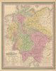
  • A new map of Germany. Austria Bohemia Moravia. THOMAS, COWPERTHWAIT 1852 A new map of Germany. Austria Bohemia Moravia. THOMAS, COWPERTHWAIT 1852
    A new map of Germany. Austria Bohemia Moravia. THOMAS, COWPERTHWAIT 1852

    £44.00

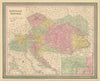
  • Austrian Empire. Austria Hungary. Lombardy Gallicia. COWPERTHWAIT 1852 old map Austrian Empire. Austria Hungary. Lombardy Gallicia. COWPERTHWAIT 1852 old map
    Austrian Empire. Austria Hungary. Lombardy Gallicia. COWPERTHWAIT 1852 old map

    £44.00

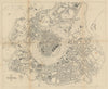
  • VIENNA WIEN antique town city plan stadtplan. Austria Österreich karte 1896 map VIENNA WIEN antique town city plan stadtplan. Austria Österreich karte 1896 map
    VIENNA WIEN antique town city plan stadtplan. Austria Österreich karte 1896 map

    £44.00

  • 'Vienne'. Vienna Wien. Fortifed town/city plan. Austria. DE FER 1705 old map 'Vienne'. Vienna Wien. Fortifed town/city plan. Austria. DE FER 1705 old map
    'Vienne'. Vienna Wien. Fortifed town/city plan. Austria. DE FER 1705 old map

    £43.00

  • VIENNA WIEN antique town plan city map. Austria. BRADSHAW 1893 old VIENNA WIEN antique town plan city map. Austria. BRADSHAW 1893 old
    VIENNA WIEN antique town plan city map. Austria. BRADSHAW 1893 old

    £42.00

  • DALMATIA BOSNIA Croatia Montenegro. Railways. Gulf of Kotor/Cattaro 1896 map DALMATIA BOSNIA Croatia Montenegro. Railways. Gulf of Kotor/Cattaro 1896 map
    DALMATIA BOSNIA Croatia Montenegro. Railways. Gulf of Kotor/Cattaro 1896 map

    £41.00

  • VIENNA Railway map. WIEN Verkehrskarte. City plan. Austria Österreich 1929 VIENNA Railway map. WIEN Verkehrskarte. City plan. Austria Österreich 1929
    VIENNA Railway map. WIEN Verkehrskarte. City plan. Austria Österreich 1929

    £41.00

  • 1
  • 2
  • 3
  • 4
  • …
  • 30
Back to Top

Be the first to explore our new discoveries.

Sign up for early access to rare finds and special offers.

2026 Antiqua Print Gallery Ltd. All rights Reserved.
  • Antiqua Print Gallery Ltd
    • Suite 204, Cumberland House 80 Scrubs Lane London NW10 6RF
    • +44 (0)208 960 3476
    • info@antiquemapsandprints.com
  • Shop By
    • Country
    • Cartographer
    • Subject
  • Discover
    • About Us
    • Blog
    • Contact Us
    • Sell to Us
    • FAQs
  • Social
    • Facebook
    • Instagram
    • Pinterest
  • Privacy Policy
  • Cookies
  • Returns
  • Delivery
  • Terms & Conditions
  • Website by Radiant
    • Website by Radiant
    • Privacy Policy
    • Cookies
    • Returns
    • Delivery
    • Terms & Conditions
  • Payment methods
    • American Express
    • Apple Pay
    • Bancontact
    • Diners Club
Payment methods
  • American Express
  • Apple Pay
  • Bancontact
  • Diners Club
2026 Antiqua Print Gallery Ltd. All rights Reserved.
  • Choosing a selection results in a full page refresh.
  • Opens in a new window.