


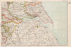


Parliamentary constituencies are picked out in colour across the maps of Bacon's Atlas of Great Britain & Ireland, the 1936 edition published in London by G. W. Bacon & Co., laid over county geography, railways, boroughs and parks. Larger English and Welsh counties are divided into manageable regional sections, Scottish sheets reach the Highlands, islands, Borders and central industrial districts, and the Irish maps keep the atlas's all-island scope with contemporary place names and administrative divisions. Mountains, coastlines and settlements accompany the political layer throughout, and the railways record the interwar transport network. Because every sheet comes from the one edition, comparing regions is straightforward.
EU orders up to €150 are sent VAT- and duty-paid — no additional taxes on arrival
Authenticity Guaranteed - We only sell original antique & vintage items
Can we help? Call us on +44-208-960-3476 • FAQs
All our products are exempt from US tariffs — no additional duties or taxes payable on arrival.


- Shop by Country
- Shop by Cartographer
- Shop Maps by Type
- Shop Prints by Subject