


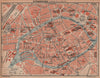




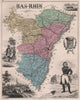


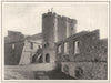

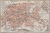


Strasbourg cathedral, the northern Vosges and the battlefields of 1870 give these maps and prints of Bas-Rhin a setting that reaches well beyond the Rhine. Department maps by Levasseur, Perrot, Malte-Brun and Vuillemin link the Alsatian towns, early fortification plans examine Strasbourg, Sélestat, Haguenau and Fort-Louis, and there are wine maps and guidebook plans. The Franco-Prussian War is a strong theme, with maps and illustrations of Wissembourg, Woerth, Reichshoffen and the siege of Strasbourg. The prints show the cathedral clock, covered bridges and civic buildings of Strasbourg, Saverne, Rosheim and the wooded uplands, the Rohan interiors, church furnishings and local costume, following Alsace through its French and German periods.
EU orders up to €150 are sent VAT- and duty-paid — no additional taxes on arrival
Authenticity Guaranteed - We only sell original antique & vintage items
Can we help? Call us on +44-208-960-3476 • FAQs
All our products are exempt from US tariffs — no additional duties or taxes payable on arrival.


- Shop by Country
- Shop by Cartographer
- Shop Maps by Type
- Shop Prints by Subject