


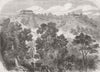


Bhutan appears here within the Himalayan borderlands of northern India and Assam, and the interest of these maps lies in how successive publishers drew the line between mountain territory and the plains below. Decorative regional sheets by Tallis and Rapkin, maps of Bengal and Assam and later atlas coverage link the country with Sikkim, Tibet and Nepal, all with period spellings, while twentieth-century editions distinguish British Indian provinces from the independent territories beside them. The prints record the Duar War at Bala Pass, Buxa Dooars and the approaches near Jalpaiguri, together with Bhutanese costume, and later plates set the national flag beside India's.
EU orders up to €150 are sent VAT- and duty-paid — no additional taxes on arrival
Authenticity Guaranteed - We only sell original antique & vintage items
Can we help? Call us on +44-208-960-3476 • FAQs
All our products are exempt from US tariffs — no additional duties or taxes payable on arrival.


- Shop by Country
- Shop by Cartographer
- Shop Maps by Type
- Shop Prints by Subject