


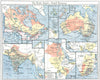

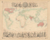

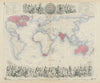


Steamship routes, telegraph cables and overseas possessions encircle the globe in these maps of the British Empire, which run from the eighteenth century to the mid-twentieth. World maps on Mercator's projection link territories with ocean passages and commercial routes, earlier North American maps show a different imperial extent, and political sheets record the changes before and after the First World War. The prints add flags, badges, coats of arms and naval signals, the emblems of colonial administrations and public services, while material associated with the British Empire Exhibition shows how the empire presented itself at Wembley.
EU orders up to €150 are sent VAT- and duty-paid — no additional taxes on arrival
Authenticity Guaranteed - We only sell original antique & vintage items
Can we help? Call us on +44-208-960-3476 • FAQs
All our products are exempt from US tariffs — no additional duties or taxes payable on arrival.


- Shop by Country
- Shop by Cartographer
- Shop Maps by Type
- Shop Prints by Subject