


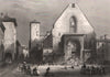

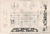


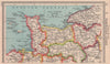

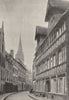





The D-Day landing beaches lie at the heart of these maps of Calvados, a detailed record of the Normandy coast and the 1944 campaign. Planning and campaign maps follow the naval assault, the fighting around Caen and operations towards Falaise, while plans of the Mulberry harbour at Arromanches show how the invasion was supplied. Earlier charts by Faden cover the Seine approaches and the coast towards Isigny, and later Admiralty sheets describe Courseulles, Ouistreham and Port-en-Bessin. Department maps and resort plans around Trouville and Deauville add a peacetime coast, and the prints show churches, houses and civic buildings in Caen, Bayeux, Lisieux and Vire.
EU orders up to €150 are sent VAT- and duty-paid — no additional taxes on arrival
Authenticity Guaranteed - We only sell original antique & vintage items
Can we help? Call us on +44-208-960-3476 • FAQs
All our products are exempt from US tariffs — no additional duties or taxes payable on arrival.


- Shop by Country
- Shop by Cartographer
- Shop Maps by Type
- Shop Prints by Subject