


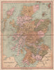


Educational atlases and the history of London meet in the maps published by William Collins and Sons, the Glasgow business founded in 1819 and run by successive generations of the Collins family. The atlas sheets cover countries, colonies and historical territories, with changing labels visible in divided Germany, colonial Australia and American Indian Territory, and Canada, New Zealand, the Caribbean and Europe widening the range. A separate London strand includes later reproductions of early surveys associated with Rocque, Ogilby, Faithorne and Newcourt, dated by their publication rather than by the surveys they reproduce, alongside maps of metropolitan boroughs and suburbs.
EU orders up to €150 are sent VAT- and duty-paid — no additional taxes on arrival
Authenticity Guaranteed - We only sell original antique & vintage items
Can we help? Call us on +44-208-960-3476 • FAQs
All our products are exempt from US tariffs — no additional duties or taxes payable on arrival.


- Shop by Country
- Shop by Cartographer
- Shop Maps by Type
- Shop Prints by Subject