


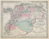

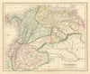



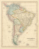


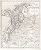


Cartagena's harbour and the high Andes offer contrasting subjects in these maps of Colombia, which run from the seventeenth century into the twentieth. Coastal plans by Bellin and others examine the port and its defences, regional sheets record New Granada, Gran Colombia and later national divisions, and maps showing Panama as part of the country predate its separation. Specialised maps cover geology, administrative divisions and Caribbean islands such as San Andrés and Providencia, and the prints include views of Bogotá and the Tequendama Falls.
EU orders up to €150 are sent VAT- and duty-paid — no additional taxes on arrival
Authenticity Guaranteed - We only sell original antique & vintage items
Can we help? Call us on +44-208-960-3476 • FAQs
All our products are exempt from US tariffs — no additional duties or taxes payable on arrival.


- Shop by Country
- Shop by Cartographer
- Shop Maps by Type
- Shop Prints by Subject