


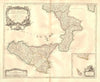


Italy before unification, divided into duchies, legations and kingdoms, dominates these maps from a composite atlas assembled from separately published eighteenth-century sheets. Unlike a uniform publisher's atlas, it brings together the French and German work of Homann, Nolin, Vaugondy and d'Anville, with varied title designs and dates from the first half of the century to its middle decades. Lazio, Mantua, Modena, Reggio, Bologna and the Kingdom of Naples each appear as distinct units, so a collector of historical Italy can compare several contemporary ways of dividing the peninsula from a single recorded provenance. West African coastal mapping takes the volume beyond Europe.
EU orders up to €150 are sent VAT- and duty-paid — no additional taxes on arrival
Authenticity Guaranteed - We only sell original antique & vintage items
Can we help? Call us on +44-208-960-3476 • FAQs
All our products are exempt from US tariffs — no additional duties or taxes payable on arrival.


- Shop by Country
- Shop by Cartographer
- Shop Maps by Type
- Shop Prints by Subject