
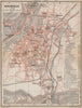

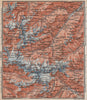


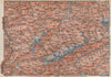
The Dolomites, the Hohe Tauern and the resorts of Tyrol are mapped for the walker and railway traveller in Eastern Alps, Karl Baedeker's guide to the eastern Alpine regions. The sheets date from 1899 to 1911 and cover the Bavarian Highlands, Tyrol, Salzburg and neighbouring Austrian and Slovenian territories under the names the guide used. Topographical maps examine the Ortler group and the valleys of the upper Inn, town plans cover Brixen, Bolzano, Bregenz and Bad Ischl, and panoramas add the mountain skylines, with Munich and the Bavarian foothills completing the approaches.
EU orders up to €150 are sent VAT- and duty-paid — no additional taxes on arrival
Authenticity Guaranteed - We only sell original antique & vintage items
Can we help? Call us on +44-208-960-3476 • FAQs
All our products are exempt from US tariffs — no additional duties or taxes payable on arrival.


- Shop by Country
- Shop by Cartographer
- Shop Maps by Type
- Shop Prints by Subject