


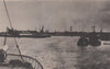

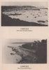


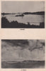




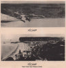

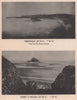

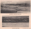

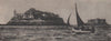

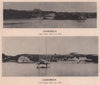







Harbour entrances and coastal approaches on both sides of the Channel fill the English Channel Handbook, the wartime publication produced by the Admiralty's Hydrographic Department in 1943. The maps, catalogued across 1943–1944, are small coastal charts, town plans and harbour details. On the English side, Beaulieu River, Cowes, Portsmouth, Lyme Bay and Hastings show estuaries, anchorages and seaside towns, while French harbour plans include places associated with preparations for the Normandy landings. They are practical hydrographic maps of coastlines, rivers, ports and approaches, made for readers who needed to understand them in wartime.
EU orders up to €150 are sent VAT- and duty-paid — no additional taxes on arrival
Authenticity Guaranteed - We only sell original antique & vintage items
Can we help? Call us on +44-208-960-3476 • FAQs
All our products are exempt from US tariffs — no additional duties or taxes payable on arrival.


- Shop by Country
- Shop by Cartographer
- Shop Maps by Type
- Shop Prints by Subject