


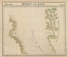


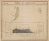


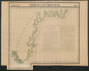



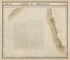

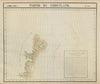




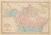


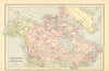


Icy fjords, Arctic coasts and settlements from Godhaven to Nuuk appear in these maps of Greenland, dating from 1683 to 2000. Place names come in many forms, so Disco, Lievely and Frederickshaab sit beside Akunnat, Alluitsoq, Narsarmijit and Ritenbenk, and the maps chart navigation routes and coastal contours. Johnston's political map of North America of 1906 shows the island beside the United States, Canada and Mexico. The prints include ethnographic and architectural subjects from 1770, such as a view of Lichtenfels and plans of traditional winter houses, recording indigenous domestic life and colonial outposts as Europeans saw them.
EU orders up to €150 are sent VAT- and duty-paid — no additional taxes on arrival
Authenticity Guaranteed - We only sell original antique & vintage items
Can we help? Call us on +44-208-960-3476 • FAQs
All our products are exempt from US tariffs — no additional duties or taxes payable on arrival.


- Shop by Country
- Shop by Cartographer
- Shop Maps by Type
- Shop Prints by Subject