


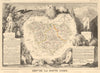

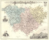


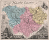


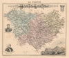
Le Puy's buildings rising among their extraordinary rocky outcrops are the highlight of these maps and prints of Haute-Loire. Levasseur's illustrated sheets and Vuillemin's departmental geography map the roads, rivers and principal towns, plans of Le Puy-en-Velay study the town more closely, and excursion maps reach La Chaise-Dieu and Craponne in the uplands. The prints give particular attention to Le Puy, including prospects from the Rocher Corneille, and nineteenth-century engravings sit beside later guidebook mapping.
EU orders up to €150 are sent VAT- and duty-paid — no additional taxes on arrival
Authenticity Guaranteed - We only sell original antique & vintage items
Can we help? Call us on +44-208-960-3476 • FAQs
All our products are exempt from US tariffs — no additional duties or taxes payable on arrival.


- Shop by Country
- Shop by Cartographer
- Shop Maps by Type
- Shop Prints by Subject