


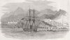




The fortress of Omoa, the Bay Islands and the Gulf of Fonseca give these maps of Honduras a strong coastal and strategic emphasis. Bellin and Schley place the country within Central America, followed by regional maps by Vandermaelen, Colton, the SDUK and Bartholomew, while more focused sheets describe the harbour of San Fernando de Omoa, Puerto Cortés and the waters around Tigre Island. The prints show Comayagua, Tegucigalpa, the church at Gracias and communities inland, and naval illustrations record the British consulate at Omoa, the bombardment of its castle and events around Trujillo and the Bay Islands. National flags and arms are also included.
EU orders up to €150 are sent VAT- and duty-paid — no additional taxes on arrival
Authenticity Guaranteed - We only sell original antique & vintage items
Can we help? Call us on +44-208-960-3476 • FAQs
All our products are exempt from US tariffs — no additional duties or taxes payable on arrival.


- Shop by Country
- Shop by Cartographer
- Shop Maps by Type
- Shop Prints by Subject