


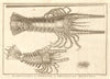


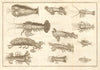

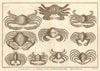


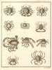


Antiques maps of the Dutch East Indies (now Indonesia), and old prints of its islands are archipelagos including Sumatra, Java, Borneo, Bali, Celebes (Sulawesi), the Sunda & Malacca islands, and of its people and tribes. Old regional maps by Dornseiffen's "Atlas van Nederlandsch Oost- en West-Indie" (1892), Mallet (1683) & Weller (1863). Skwtch maps and engarved prints from Elisee Reclus's "Universal Geography" (1885) and other 19th century views from the "Illustrated London News"
EU orders up to €150 are sent VAT- and duty-paid — no additional taxes on arrival
Authenticity Guaranteed - We only sell original antique & vintage items
Can we help? Call us on +44-208-960-3476 • FAQs
All our products are exempt from US tariffs — no additional duties or taxes payable on arrival.
- Shop by Country
- Shop by Cartographer
- Shop Maps by Type
- Shop Prints by Subject