


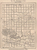


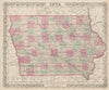


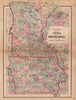


River towns on the Mississippi, prairie counties and the public-land surveys that organised the American Midwest all appear in these maps of Iowa. Colton and Johnson atlas sheets show the counties and neighbouring states, federal survey maps examine the public lands and Dubuque harbour, and plans of the railway facilities at Sioux City, Council Bluffs and Des Moines bring individual towns into focus. Charles Royce's maps of land cessions record the Indigenous side of that history, as do George Catlin's Upper Mississippi landscapes and images of Sauk and Meskwaki people among the prints, which also show bluffs, bridges, paddle steamers and timber rafts at Davenport and Dubuque. Later railway and highway sheets cross the state, and pictorial maps by Ruth Taylor White and Jacques Liozu bring it into the twentieth century.
EU orders up to €150 are sent VAT- and duty-paid — no additional taxes on arrival
Authenticity Guaranteed - We only sell original antique & vintage items
Can we help? Call us on +44-208-960-3476 • FAQs
All our products are exempt from US tariffs — no additional duties or taxes payable on arrival.


- Shop by Country
- Shop by Cartographer
- Shop Maps by Type
- Shop Prints by Subject