


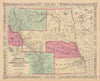


Land cessions, reservations, stockyards and railways all feature in these maps and prints of Kansas. Public-survey sketches and territorial and state sheets by Johnson and Colton lead to the land-cession maps associated with Royce and later county maps by Cram and Rand McNally, which record reservations as well as counties, and highway and railway maps carry the record into the twentieth century. Kansas City plans cross the state line into Missouri, and river studies around Atchison link the state with the Missouri valley. The prints include the capitol at Topeka, stockyard scenes and Catlin material relating to the Kaw, Ioway and other peoples of the state and the wider Plains.
EU orders up to €150 are sent VAT- and duty-paid — no additional taxes on arrival
Authenticity Guaranteed - We only sell original antique & vintage items
Can we help? Call us on +44-208-960-3476 • FAQs
All our products are exempt from US tariffs — no additional duties or taxes payable on arrival.


- Shop by Country
- Shop by Cartographer
- Shop Maps by Type
- Shop Prints by Subject