


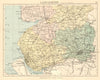


Parliamentary boundaries give these antique maps of Lancashire a particular historical edge, recording how towns were defined for political purposes rather than as a modern road map shows them. Nineteenth-century plans of Clitheroe and Lancaster appear with parliamentary sheets for Liverpool, Manchester and the county divisions, and the historic county they describe may differ from present administrative arrangements. Old views show the appearance of the towns, and a borough plan set beside a county sheet relates an urban centre to its surroundings across material spanning several centuries.
EU orders up to €150 are sent VAT- and duty-paid — no additional taxes on arrival
Authenticity Guaranteed - We only sell original antique & vintage items
Can we help? Call us on +44-208-960-3476 • FAQs
All our products are exempt from US tariffs — no additional duties or taxes payable on arrival.


- Shop by Country
- Shop by Cartographer
- Shop Maps by Type
- Shop Prints by Subject