


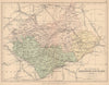


Leicestershire has been mapped in strikingly different styles, from John Speed’s county map with its inset plan of Leicester to J. L. Carr’s anecdotal pictorial map of local history. Between them come Richard Blome and Robert Morden, John Cary’s regional sheets, the Ordnance Survey and Greenwood’s survey with its vignette of Belvoir Castle. The prints record castles, churches and country houses, among them Thomas Allom’s view of the ruins at Ashby-de-la-Zouch, while Charnwood Forest and the county’s market towns appear across both maps and views.
EU orders up to €150 are sent VAT- and duty-paid — no additional taxes on arrival
Authenticity Guaranteed - We only sell original antique & vintage items
Can we help? Call us on +44-208-960-3476 • FAQs
All our products are exempt from US tariffs — no additional duties or taxes payable on arrival.


- Shop by Country
- Shop by Cartographer
- Shop Maps by Type
- Shop Prints by Subject