


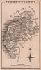


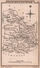


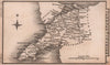

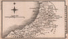


Pocket-sized counties for early nineteenth-century travellers make up Leigh's County Maps of England & Wales, published in London by Samuel Leigh in 1820 and engraved by Sidney Hall. Each small sheet shows the county's towns, roads and rivers in clear outline and tightly arranged lettering, a road network from before the railways. English coverage runs from Cornwall and Devon to Cumberland, with Yorkshire divided into its ridings and the Isle of Wight treated separately, while the Welsh maps keep names such as Brecknockshire, Cardiganshire and Caernarvonshire. The whole set fitted in a volume far smaller than a folio atlas.
EU orders up to €150 are sent VAT- and duty-paid — no additional taxes on arrival
Authenticity Guaranteed - We only sell original antique & vintage items
Can we help? Call us on +44-208-960-3476 • FAQs
All our products are exempt from US tariffs — no additional duties or taxes payable on arrival.


- Shop by Country
- Shop by Cartographer
- Shop Maps by Type
- Shop Prints by Subject