


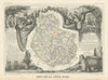

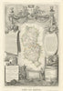


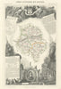

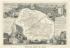

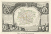

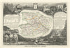


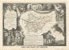


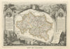


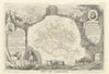

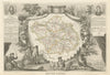

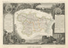

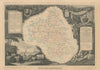


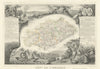


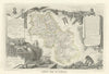


Victor Levasseur was a prolific French cartographer active between 1838 and 1854. He is best known for his large, highly decorative maps published in the Atlas National Illustré des 86 Départements et des Possessions de la France, first issued in 1847. These maps are distinguished by their elaborate borders, richly embellished with vignette views of towns, cities, and notable figures associated with each region, along with extensive historical and geographical commentary. Levasseur’s work is as valued for its artistic appeal as for its informational content. Notably, some editions of his maps of North America depict Texas as an independent nation, reflecting its brief period as the Republic of Texas prior to annexation by the United States.
EU orders up to €150 are sent VAT- and duty-paid — no additional taxes on arrival
Authenticity Guaranteed - We only sell original antique & vintage items
Can we help? Call us on +44-208-960-3476 • FAQs
All our products are exempt from US tariffs — no additional duties or taxes payable on arrival.
- Shop by Country
- Shop by Cartographer
- Shop Maps by Type
- Shop Prints by Subject