




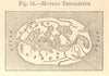
The Gulf of Sidra, Cyrenaica and the desert reaches of the Fezzan feature in these maps of Libya, dating from 1572 to 1973. Plans of Tripoli and coastal views of Bombah and Cap Razatin sit beside maps of ancient North Africa and the Mediterranean, some with regional flags. Second World War charts follow the North African campaign, including the Second Battle of Sirte in March 1942, convoy routes and military tracks around Castel Benito and El Adem. Mid-twentieth-century press graphics and survey material are here too, among them Sandhurst expedition maps of Gebel Archenu.
EU orders up to €150 are sent VAT- and duty-paid — no additional taxes on arrival
Authenticity Guaranteed - We only sell original antique & vintage items
Can we help? Call us on +44-208-960-3476 • FAQs
All our products are exempt from US tariffs — no additional duties or taxes payable on arrival.


- Shop by Country
- Shop by Cartographer
- Shop Maps by Type
- Shop Prints by Subject