


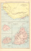


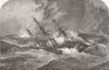



A brig's track through a hurricane, the Midland Railway's bridge over the Grand River and the island's birds feature among these maps and prints of Mauritius, many of them using its former name, Île de France. Eighteenth-century sheets by Bonne and decorative Indian Ocean maps associated with Tallis and Rapkin set the island beside Réunion, Madagascar and the Seychelles, while separate maps treat it alone. The plotted course of the brig Charles Heddle records the dangers of navigation in these waters. The prints show bridges and railway works, and later flags add a political subject, with French and English place names used side by side.
EU orders up to €150 are sent VAT- and duty-paid — no additional taxes on arrival
Authenticity Guaranteed - We only sell original antique & vintage items
Can we help? Call us on +44-208-960-3476 • FAQs
All our products are exempt from US tariffs — no additional duties or taxes payable on arrival.


- Shop by Country
- Shop by Cartographer
- Shop Maps by Type
- Shop Prints by Subject