


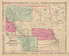


Montana spans the northern Rocky Mountains and the Plains, and its maps follow the country from the 1860s sheets of Colton, Johnson and Mitchell to county maps by Cram, Bartholomew and Rand McNally and the highway and railroad maps Poates issued in 1925. Charles Royce's maps of 1899 trace the land cessions of the Blackfoot, Crow, Flathead, Assiniboin and Piegan, a 1903 map marks the battlefields of the Sioux war of 1876 and 1877, and the USGS charted the coal fields in 1902. George Catlin's plates, first published in 1841, portray Blackfeet, Crow and Assiniboine chiefs and families and show Fort Union at the mouth of the Yellowstone. Views from the 1890s take in Main Street in Butte, Kootenai Falls, the Missouri below Great Falls and the Broadwater Hotel at Helena, while Ruth Taylor White's pictorial map of 1935 gives the state a lighter touch.
EU orders up to €150 are sent VAT- and duty-paid — no additional taxes on arrival
Authenticity Guaranteed - We only sell original antique & vintage items
Can we help? Call us on +44-208-960-3476 • FAQs
All our products are exempt from US tariffs — no additional duties or taxes payable on arrival.


- Shop by Country
- Shop by Cartographer
- Shop Maps by Type
- Shop Prints by Subject