


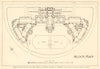


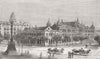


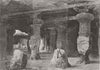

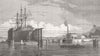


Maps of plague cases, rats and affected houses set this collection apart, recording Mumbai, still Bombay on these sheets, during the Third Plague Pandemic. Detailed plans of the Fort districts and Sion village chart the spread of the disease and experimental observations, at a very different scale from the street plans showing docks, public buildings and transport. Regional sheets set the city within its presidency, western India and the railway network, and local maps reach Parel, Salsette and nearby settlements. The prints show the inhabitants and city scenes, in material from the eighteenth to the twentieth century.
EU orders up to €150 are sent VAT- and duty-paid — no additional taxes on arrival
Authenticity Guaranteed - We only sell original antique & vintage items
Can we help? Call us on +44-208-960-3476 • FAQs
All our products are exempt from US tariffs — no additional duties or taxes payable on arrival.


- Shop by Country
- Shop by Cartographer
- Shop Maps by Type
- Shop Prints by Subject