


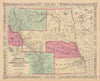


Nebraska passes on these maps from a vast western territory to a state divided into counties and crossed by railways. Johnson and Colton sheets show its changing borders with Kansas, Dakota, Montana and Wyoming, so territorial maps can include land beyond today's state line, and public survey maps lay out the land on its ordered grid. Later maps emphasise railways, highways and cities such as Omaha and Lincoln. Royce's land-cession maps and Catlin's subjects record the Pawnee, Omaha, Ponca and other Indigenous communities along the Missouri and Platte, and the prints show camps, prairie bluffs and Chimney Rock alongside Union Pacific stations, the Missouri bridge and civic buildings.
EU orders up to €150 are sent VAT- and duty-paid — no additional taxes on arrival
Authenticity Guaranteed - We only sell original antique & vintage items
Can we help? Call us on +44-208-960-3476 • FAQs
All our products are exempt from US tariffs — no additional duties or taxes payable on arrival.


- Shop by Country
- Shop by Cartographer
- Shop Maps by Type
- Shop Prints by Subject