


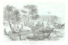


A canal to join two oceans runs through much of Nicaragua's printed geography, linking its great lakes and the San Juan River to nineteenth-century schemes for an interoceanic passage. The maps compare routes across Nicaragua and Panama, examine the Isthmus of Rivas and follow the river towards Greytown, while regional sheets by Bellin, Tallis, Johnston and other publishers and thematic sketches of political divisions, volcanoes and mountain barriers set the plans in context. The prints include George Cooper's lithographs of San Juan, El Realejo and Chinandega, lakeside travel, markets and washing scenes, and the volcanoes of Momotombo, Mombacho and the Maribios range.
EU orders up to €150 are sent VAT- and duty-paid — no additional taxes on arrival
Authenticity Guaranteed - We only sell original antique & vintage items
Can we help? Call us on +44-208-960-3476 • FAQs
All our products are exempt from US tariffs — no additional duties or taxes payable on arrival.


- Shop by Country
- Shop by Cartographer
- Shop Maps by Type
- Shop Prints by Subject