


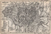


Ecclesiastical states and coalfield railways give these maps of North Rhine-Westphalia two very different worlds, gathered under a modern name. Earlier sheets by Münster, Bertius and Seutter show the electorate of Cologne, the bishopric of Paderborn, Cleves and the Westphalian and Rhenish circles, while later maps link the Rhine towns with the railways, coalfields and industries of the Ruhr. City plans cover Cologne, Düsseldorf, Aachen, Essen and neighbouring centres, and battle plans and wartime material run from Minden to the Möhne dam. The prints show buildings, public occasions and local prospects, including the inauguration of Beethoven's statue at Bonn.
EU orders up to €150 are sent VAT- and duty-paid — no additional taxes on arrival
Authenticity Guaranteed - We only sell original antique & vintage items
Can we help? Call us on +44-208-960-3476 • FAQs
All our products are exempt from US tariffs — no additional duties or taxes payable on arrival.


- Shop by Country
- Shop by Cartographer
- Shop Maps by Type
- Shop Prints by Subject