


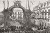


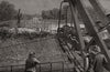


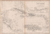


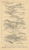


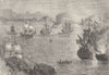

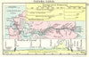


Canal routes, the Darien isthmus and the castle of San Lorenzo fill these maps of Panama, dated between 1683 and 1987. Maps by Tallis, Rapkin, Bellin, Schley, Swanston, Johnston and Stanford trace proposed canal routes, the railway crossing and the maritime channels, and record Chagres, Colon, San Miguel Bay, Mount Ancon and the Chagres River at Matachin. Further sheets detail the town of Porto Bello and Coiba Island, and wider charts place the isthmus between the Caribbean and South America. Prints add landscape views, historical structures and canal profile sections.
EU orders up to €150 are sent VAT- and duty-paid — no additional taxes on arrival
Authenticity Guaranteed - We only sell original antique & vintage items
Can we help? Call us on +44-208-960-3476 • FAQs
All our products are exempt from US tariffs — no additional duties or taxes payable on arrival.


- Shop by Country
- Shop by Cartographer
- Shop Maps by Type
- Shop Prints by Subject