


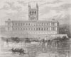


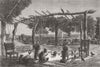


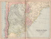


Contested frontiers and great rivers give Paraguay an outline that keeps changing in these maps, so the date of each one is central to its story. Earlier maps place the country within the broad La Plata region, while later sheets separate it from Brazil, Argentina and Bolivia, paying close attention to the Chaco, the river boundaries and the territory claimed or lost in successive wars. Maps of the yerba maté districts and the Paraguay–Paraná waterways link settlement with trade. The prints show Asunción and its public buildings, Humaitá, Jesuit churches and scenes from the War of the Triple Alliance, with river travel, markets, rural camps and Indigenous communities.
EU orders up to €150 are sent VAT- and duty-paid — no additional taxes on arrival
Authenticity Guaranteed - We only sell original antique & vintage items
Can we help? Call us on +44-208-960-3476 • FAQs
All our products are exempt from US tariffs — no additional duties or taxes payable on arrival.


- Shop by Country
- Shop by Cartographer
- Shop Maps by Type
- Shop Prints by Subject