
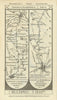

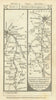

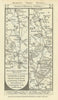

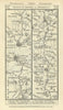

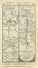

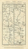

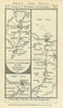

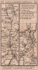

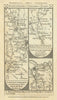

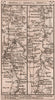

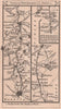

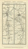

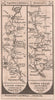

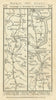

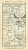

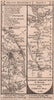

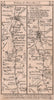

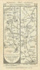

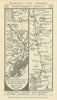

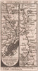

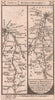

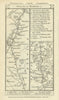

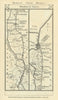

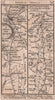

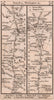


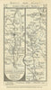

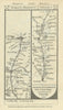

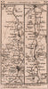

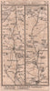

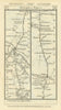

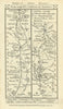

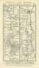

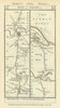

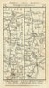
Paterson’s British Itinerary, compiled by Daniel Paterson, Esq. and published by Bowles & Carver, London, was a popular late 18th- and early 19th-century road book designed to assist travellers navigating the expanding road network of Britain. Issued in multiple editions from the 1780s onwards, it offered detailed turn-by-turn directions along principal and secondary routes across England, Wales, and Scotland, often including distances, staging posts, and landmarks. The work is especially known for its strip maps—elongated, panelled maps showing roads in sequence—which allowed travellers to follow routes visually from one town to the next. Paterson, a military officer and assistant to the Quartermaster-General, drew on official sources and surveys, and the maps were engraved with clarity and precision, typical of the Bowles family’s cartographic output. The British Itinerary was both a practical tool and a reflection of growing mobility, tourism, and commercial travel in Georgian Britain. It was one of the last British atlases to include road strip maps; the railway boom effectively killed the mail coach system on most long distance routes by the 1830s.
EU orders up to €150 are sent VAT- and duty-paid — no additional taxes on arrival
Authenticity Guaranteed - We only sell original antique & vintage items
Can we help? Call us on +44-208-960-3476 • FAQs
All our products are exempt from US tariffs — no additional duties or taxes payable on arrival.
- Shop by Country
- Shop by Cartographer
- Shop Maps by Type
- Shop Prints by Subject