


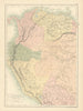


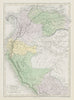


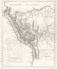


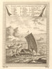







Pacific ports, the Andean interior and early accounts of the Amazon beyond make these antique maps of Peru unusually varied. Lima, Callao, Cusco and Paita appear in local plans, while Moll, Vandermaelen, Tallis and other atlas publishers place them in a wider continental setting, sometimes on nineteenth-century maps of Peru and Bolivia together. Borders have moved: Arica appears in nineteenth-century material as a Peruvian port, though it now lies in Chile, and surveys of the River Heath and the Peru–Bolivia boundary show how remote frontiers were described. The prints add city views, coastal craft and images of Inca culture and local inhabitants.
EU orders up to €150 are sent VAT- and duty-paid — no additional taxes on arrival
Authenticity Guaranteed - We only sell original antique & vintage items
Can we help? Call us on +44-208-960-3476 • FAQs
All our products are exempt from US tariffs — no additional duties or taxes payable on arrival.


- Shop by Country
- Shop by Cartographer
- Shop Maps by Type
- Shop Prints by Subject