
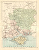

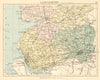

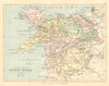

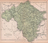

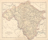

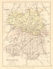

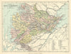

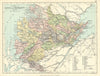

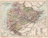

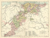

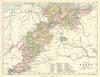

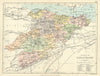

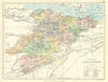

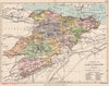

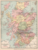

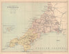

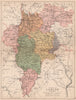

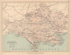

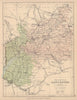

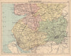

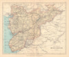

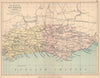

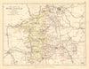

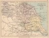

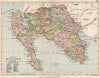

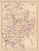

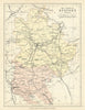

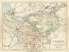

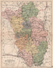

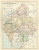

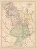

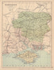

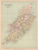

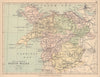

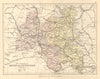

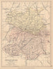
Philip’s Handy Atlas series offered a compact and accessible geographical reference to the counties of the British Isles. Published in the late 19th and early 20th centuries by the prolific cartographic firm George Philip & Son, the series included Philip’s Handy Atlas of the Counties of England, Ireland, Scotland and Wales. Each volume contained finely engraved, colour-printed maps, frequently based on cartography by John Bartholomew, one of the leading mapmakers of the era. The maps featured clear delineation of county boundaries, railways, roads, rivers, and principal towns, providing both practical detail and visual appeal. Many editions included indexes of towns and population statistics drawn from the latest censuses, making them valuable tools for educators, travellers, and households alike. Compact in format but rich in information, the Handy Atlases exemplified Philip’s mission to make geography widely accessible.
EU orders up to €150 are sent VAT- and duty-paid — no additional taxes on arrival
Authenticity Guaranteed - We only sell original antique & vintage items
Can we help? Call us on +44-208-960-3476 • FAQs
All our products are exempt from US tariffs — no additional duties or taxes payable on arrival.
- Shop by Country
- Shop by Cartographer
- Shop Maps by Type
- Shop Prints by Subject